The island is in the Ría de Arousa, opposite Carril (Vilagarcía de Arousa). You get there by sea, by boat or kayak, and only occasionally on foot at very low tides.
There is no public transport to Cortegada. The usual way to get there is by boat from the port of Carril (also from Vilanova de Arousa or A Illa de Arousa), always at high tide, or by kayak from Bamio beach. Visits are with authorised guides and limited to 125 people a day.
Cortegada lies in the inner Ría de Arousa, in the municipality of Vilagarcía de Arousa (Pontevedra, Galicia), very close to the mouth of the River Ulla. It is about 200 metres from Carril, separated by a sandbar that appears at low tide.
Together with the islets of Malveira Grande, Malveira Chica, O Con and Briñas it forms the Cortegada archipelago, one of the four in the Atlantic Islands of Galicia National Park, along with Cíes, Ons and Sálvora.
Approximate coordinates: 42°37′ N, 8°47′ WBecause the water is so shallow, boat trips can only run at high tide. Always check the tides before choosing a date.
A transfer from the port of Carril or other nearby ports, such as Vilanova de Arousa or A Illa de Arousa, to the Cortegada jetty. It's the most comfortable and quickest option. Private boats need prior permission from the National Park.
Boat tripDeparture from Bamio beach, paddling across the mouth of the River Ulla past the Carril clam beds to the island's jetty. With qualified National Park guides.
Kayak routeAt very low tides the Camino del Carro appears, linking the island to Carril. It isn't the recommended route: the tide comes in very fast and the path crosses the shellfish beds.
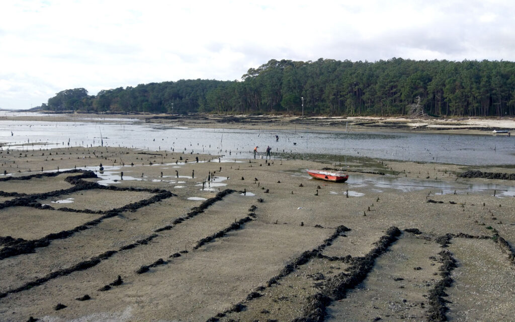
The island is joined to the mainland by a sandbar 189 metres wide, covered at high tide and exposed at low tide. The Camino del Carro was built on this sandbank, an ideal setting for farming the famous Carril clams.
Tides change quickly here, so walking along the path can be dangerous. And the shellfish gatherers aren't too happy about people walking on their clam beds.
If you decide to cross, only do so at a very low tide, check the Vilagarcía de Arousa tide table first and allow plenty of time to get back.
Carril and Bamio are part of Vilagarcía de Arousa, in the province of Pontevedra. The port of Carril is where boats to the island usually leave from, and Bamio beach, a few kilometres away, is the starting point of the kayak route.
Vilagarcía de Arousa has a train station on the line linking A Coruña, Santiago de Compostela, Pontevedra and Vigo, and good road links to the rest of the Rías Baixas. The company you book with will tell you the exact meeting point.
The island is limited to 125 visitors a day and groups are always accompanied by authorised guides.
Departures depend on the tides: book in advance.
You may only walk on paths open to the public.
There are no bins: take your rubbish with you, including cigarette ends.
The island is very damp: wear comfortable shoes and bring a warm layer or raincoat.
Several authorised companies run boat and kayak trips with qualified guides. Tell us what you're looking for and we'll put you in touch with them.